Basic Site Plan Package – Example Sheets
These examples demonstrate the structure and clarity included in the Basic Site Plan Package. For additional terrain analysis and mapped site constraints, see the Expanded Site Plan Package below.
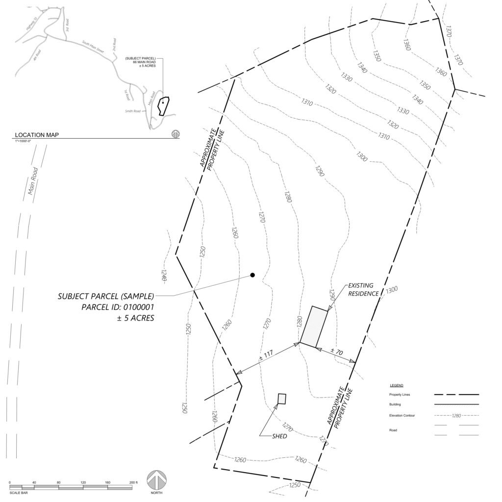
Existing Conditions Plan (Linework)
Existing conditions plan showing approximate parcel boundaries, mapped structures, topographic contours, and reference measurements.
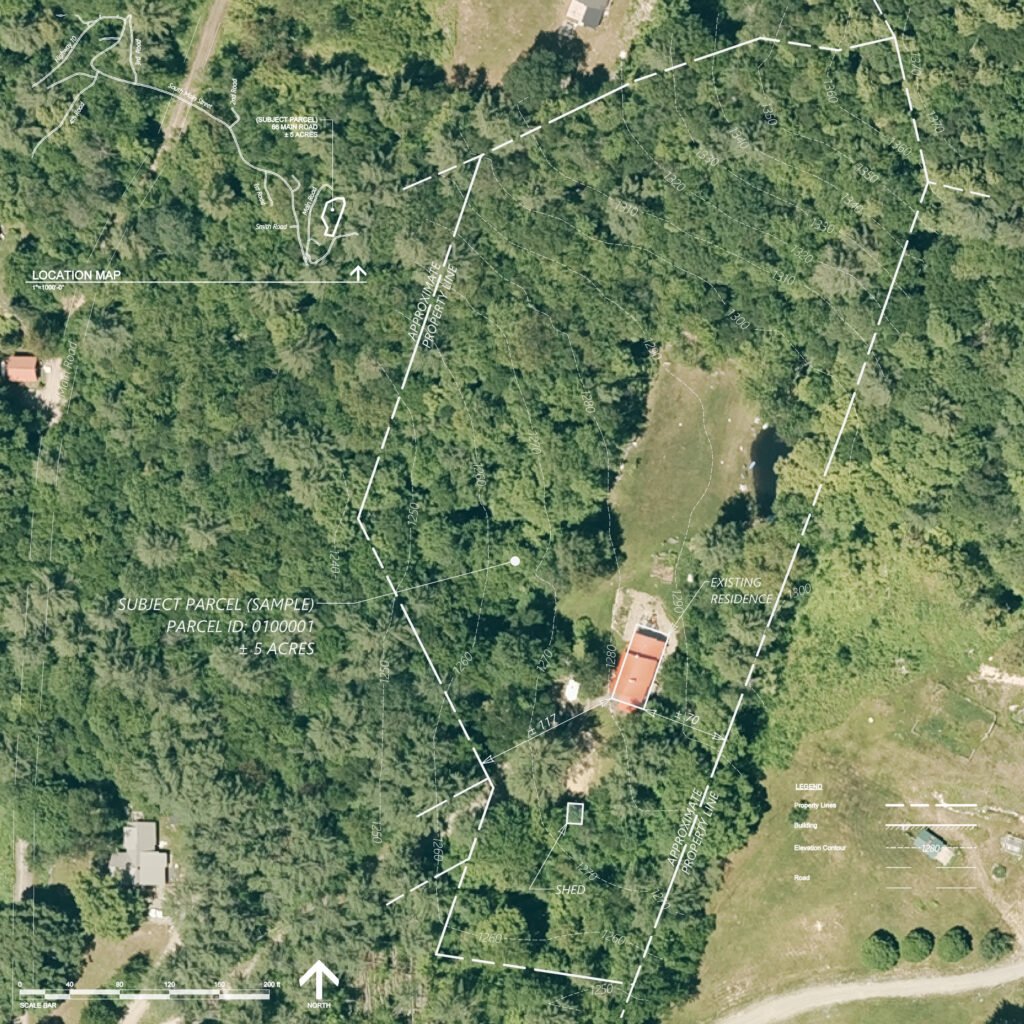
Existing Conditions Plan (Aerial)
Aerial imagery base plan with overlaid parcel boundaries, structures, and contour information for visual site context.
Expanded Site Plan Package – Example Sheets
The Expanded Site Plan Package enhances the Basic plan with terrain analysis, mapped constraints, and surface evaluation to provide a deeper understanding of site conditions prior to design or permitting.
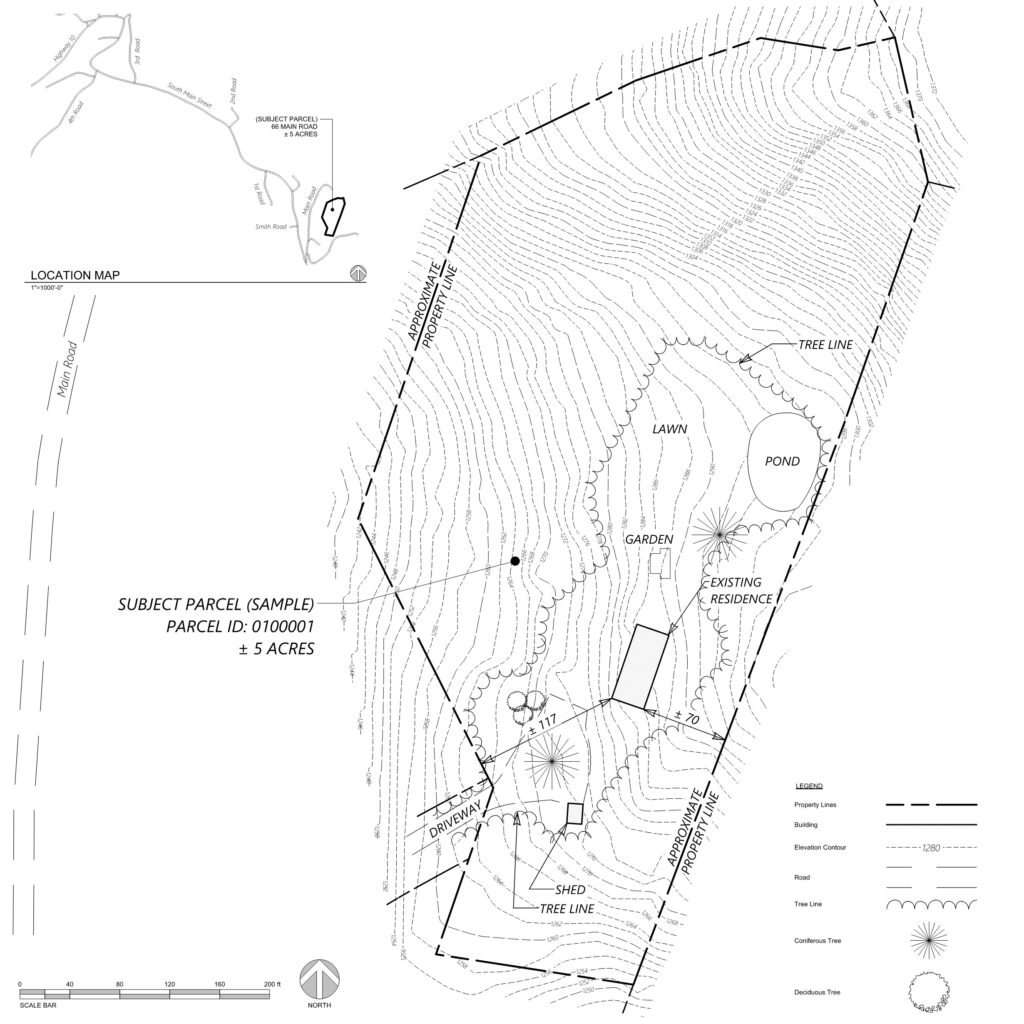
Detailed Existing Conditions
Expanded existing conditions plan with estimated surface extents, expanded contour mapping, and organized site annotations.
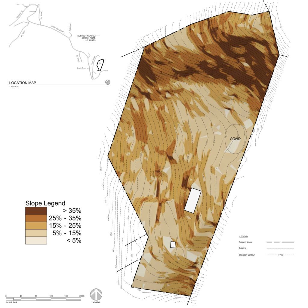
Terrain & Slope Analysis
Slope analysis plan evaluating terrain conditions to support early site feasibility review.
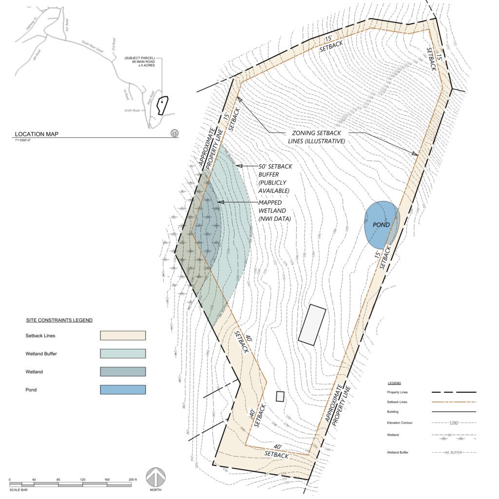
Site Constraints Map
Illustrative zoning setback lines and mapped environmental features based on publicly available data.